

Description
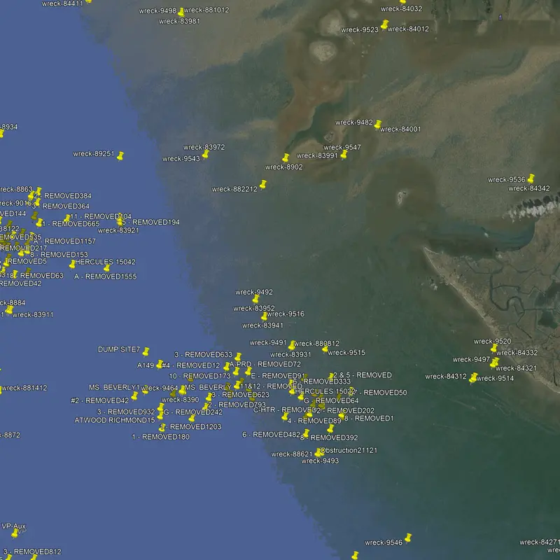
This extensive fishing spot package contains over 1800 fishing spots along the western Louisiana coastline to approximately 15 miles offshore. Spots range from Vermillion Bay in the west to just east of Cailou Bay. This package also includes many removed oil well locations, pipelines, and public reefs as well as private spots sourced by our team.
Anglers can confidently cast their lines on our spots and reel in a diverse array of sought-after coastal and offshore species, including but not limited to Snook, Redfish, Black Drum, Black Seabass, Snappers, and Grunts.
Compatible with Garmin, Simrad, Lowrance, Raymarine, B&G, Humminbird and Furono MFDs. Also, the apps from those manufacturers, Any mobile device or tablet running GPS Mapping software like Active Captain, Navionics, Aquamaps, Base Camp, GPX Studio, Google Earth, and many others.

Reviews
There are no reviews yet.